By: Jonathan Trantham, Sales Associate

Featured in Land Investor Magazine Volume 7
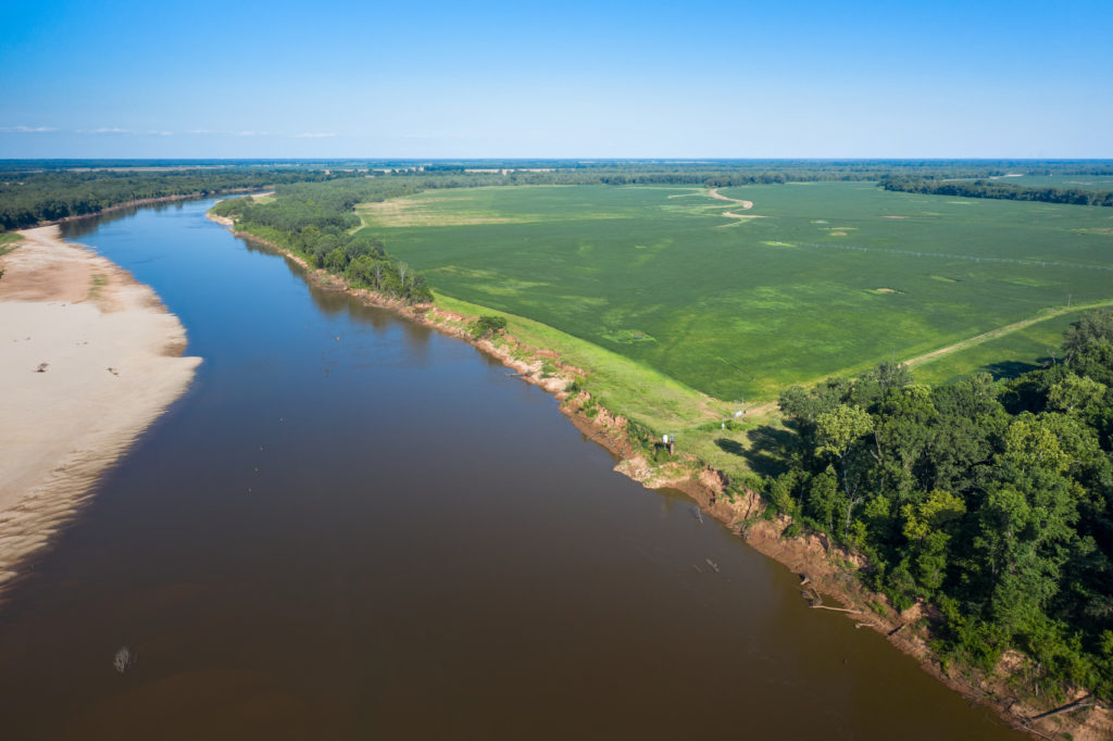
The Red River is a major tributary of the Mississippi River that stretches for more than 1,300 miles from the sunset-colored Palo Duro Canyon of the Texas Panhandle to its emerald green confluence with the Mississippi River in Louisiana. The Red River touches the state of Texas for 640 miles and is truly iconic in terms of its regional significance. This river is much more than a squiggly reddish line on the satellite map separating Oklahoma from Texas. True to its name, the Red River has a colorful and storied past. Its fascinating tales of early explorers, Indian battles, and legendary cattle trails are certainly worth pursuing if you are a lover of Texas and Oklahoma history.
My career seems to have focused on marketing farms and ranches near or on the Red River, which has given me a unique perspective and appreciation for the Red River Valley area. I consider it a beautiful and underappreciated area that deserves a closer look in general, and more specifically, as a great place to purchase recreational, agricultural, and investment land.
Palo Duro Canyon to Childress (Prairie Dog Fork of the Red River)
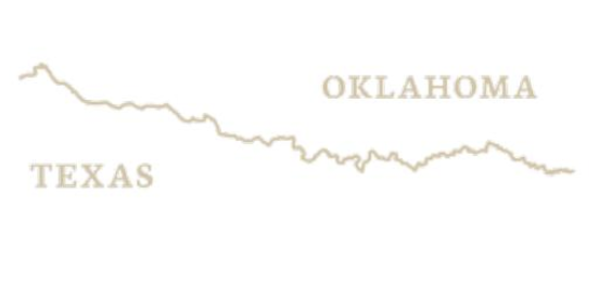
The Prairie Dog Fork of the Red River flows 160 miles southeastward through the Palo Duro Canyon, across southwestern Armstrong and northeastern Briscoe counties. It continues out of the canyon and eastward across the broken country of central Hall and Childress counties to its confluence with the North Fork of the Red River, twelve miles northeast of Vernon. There the Red River proper begins. When the Prairie Dog Town Fork crosses the 100th meridian at the eastern line of Childress County, its south bank becomes the state boundary between Texas and Oklahoma.
This section of the Red River Valley is marked by rugged topography that is colorful, wild, and harsh. The ruddy hue of the local soil in this area contributes to the namesake color of the water. The summers are hot, the winters are cold, and the skies are big. The area evokes a sense that you are peeking into something that hasn’t changed much in the last 100 years. The ranches and farms that border this section of the river are typically vast and often have been in the family for generations. The hunting in this area is excellent, and land prices are relatively low compared with prices downstream.
Burkburnett to I-35
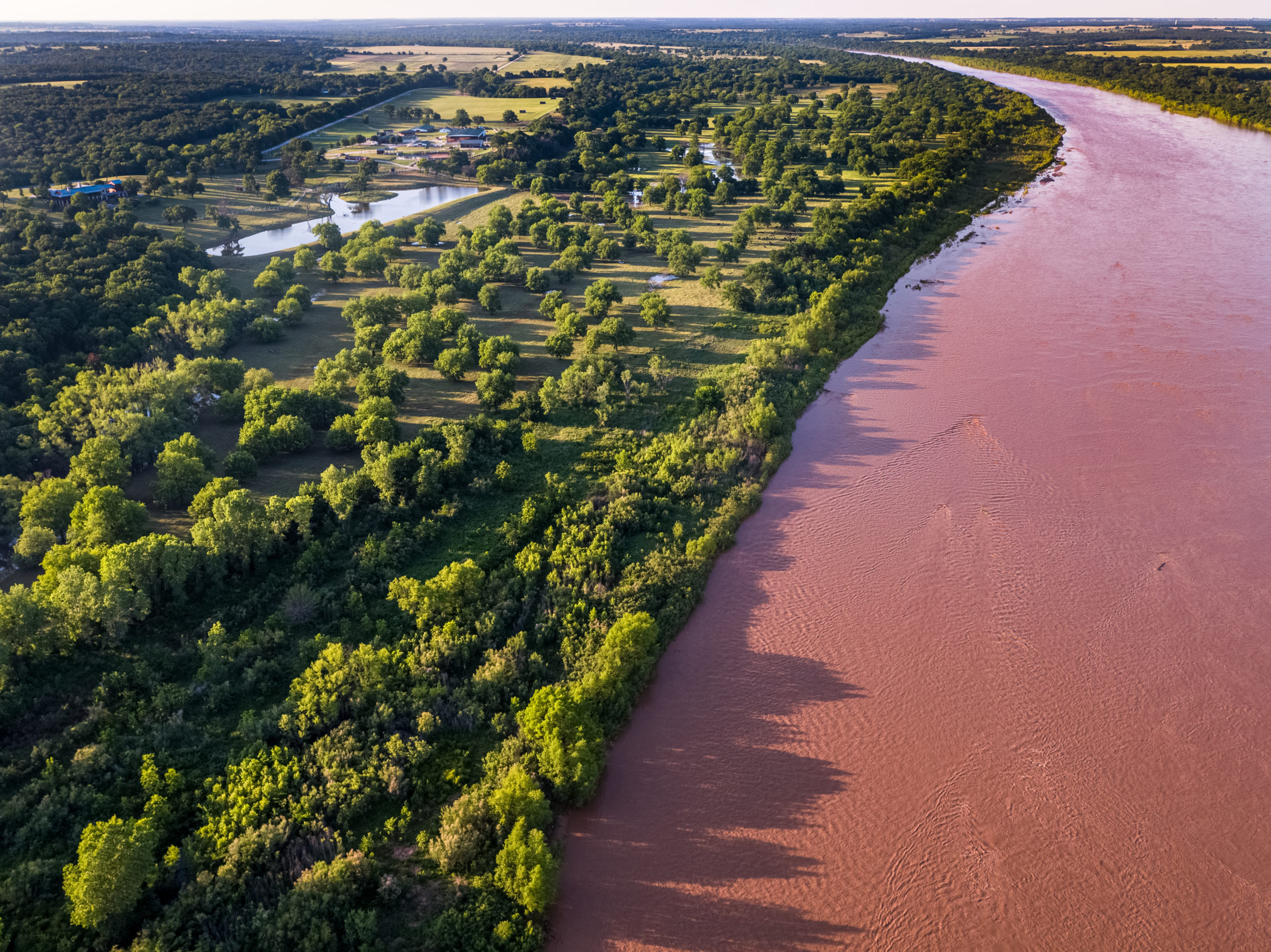
As the Red River moves eastward from I-44, it widens a little, and the surrounding vegetation becomes increasingly verdant. It is easy to spot this transition on a satellite map. On the Texas side of the river, Montague and Cooke Counties conceal one of the most underappreciated and scenic areas within a three-hour drive of the DFW Metroplex. Along HWY 82, you will find the towns of Nocona, St. Jo, and Muenster. These three towns are certainly worth exploring. St. Jo is a cowboy town located on the historic Chisholm Trail and Muenster, with its German character, is still home to the descendants of early German settlers. Muenster annually hosts an extremely well visited Germanfest and Oktoberfest. North of these towns, there is a surprising amount of topographical interest and neatly kept ranches dotted with mature post oaks and cut by tree-lined creeks. In this section of the river, the Oklahoma side is more level and agriculturally focused.
Lake Texoma
This lake is the jewel of the Red River. Texoma is a massive reservoir covering around 90,000 surface acres. It is the only impoundment on the Red River in Texas and Oklahoma and was completed in 1944 with the construction of the Denison Dam. Denison Dam is a hydroelectric dam that helps meet the increasing demand for power in the area. Texoma is also fed by the Washita River where it joins the Red River near the eastern side of the lake. Texoma is a world-class striped bass fishery and a great place to catch smallmouth bass—which aren’t common in the area. The Texas side of the lake is quite hilly and mostly cut up into smaller home site ranches. The Oklahoma side of the lake has some great recreational and agricultural options. The land prices around Texoma are relatively pricey given the proximity to the lake and the Metroplex.
Lake Texoma to Arkansas
Moving downstream from Denison Dam, you will quickly encounter Denison, TX, which is the birthplace of Dwight Eisenhower. This small, historic city has a population of about 25,000, a vibrant downtown, and the Texoma Medical Center. The section of the Red River from Denison to the Arkansas line is home to some of the most productive farmland in the south-central United States. Many farms that front the river on both sides take advantage of highly fertile Class 1 soils and river pumping rights—allowing for center pivot irrigation. Consequently, farmland near or on the Red River is some of the most sought after in the region. The primary crops in this area are corn and soybeans, but you will also see wheat, milo, and sod grass.
The Red River Valley is certainly worthy of consideration if you’re looking for a ranch to invest in. The area is both rich in history and boasts some truly spectacular scenery and land, making it an ideal place for a recreational or working ranch for your family.